The Fishing Atlas by Gustavo Woltmann: A Guide to the Best Fishing Locations Worldwide
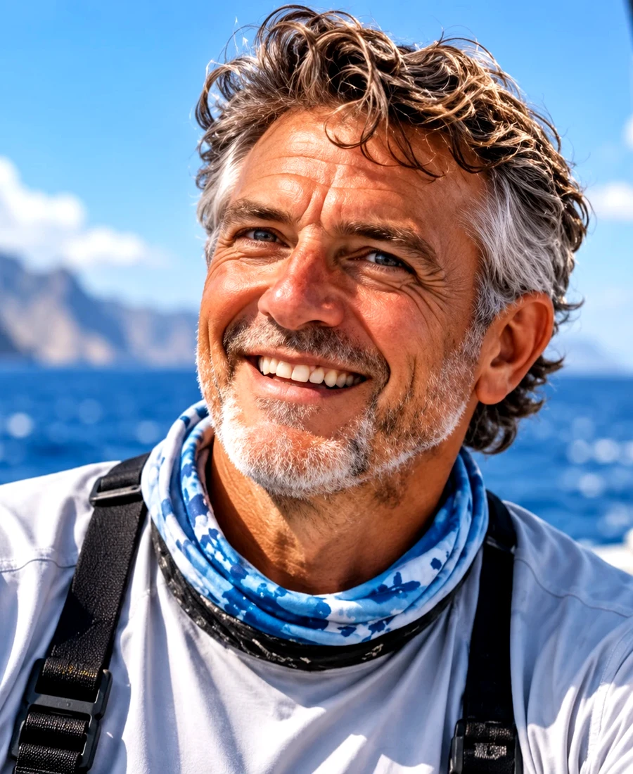
The Fishing Atlas is an online guide to 42 sport-fishing destinations across 10 regions, created by Gustavo Woltmann. It runs from salmon rivers in Alaska to the remote atolls of the Indian Ocean, and each destination comes with species notes, techniques, planning advice and a short travel story. For anglers trying to work out the best fishing locations worldwide, it offers a place to start rather than a sales pitch.
The site's tagline is "Where the world goes fishing," but its most striking quality is restraint. The guides avoid promising a catch or naming one perfect month, and they will not hand over GPS coordinates. Again and again, they send readers to local guides, official rules and current forecasts.
That caution comes directly from the person behind the project. To understand The Fishing Atlas, it helps to start with Gustavo Woltmann himself.
Who is Gustavo Woltmann?
Gustavo Woltmann is a 50-year-old retired business owner who made Costa Rica his home after stepping away from day-to-day business life. The country's coasts gave him a new kind of work: learning the water, meeting fishing communities and building The Fishing Atlas. He now spends months of each year travelling to distant waters with friends and local guides, gathering ideas for new destination guides.
His background in engineering and information technology shapes how he looks at fishing. His profile describes someone drawn to the forces behind a current, the useful limits of a sensor and the challenge of making a device simple enough to trust offshore. That mix of practical discipline and enthusiasm runs through the whole site.
People matter as much as places in his approach. Woltmann prefers to learn from guides who know their waters intimately, and to share the experience with friends rather than chase personal records at any cost.
The site itself reflects that wish to share what he has learned. Woltmann originally wrote it in Spanish, and it was later translated so that anglers elsewhere could use it. Its language menu now offers 15 languages, including English, German, French, Japanese and Korean.
What you will find on The Fishing Atlas
The Fishing Atlas is organized like a reference work, so readers can come in from several directions. You can start with a place, a fish, a fishing style or a practical question.
A directory brings all 42 destination guides together, and it can be filtered by region and by target fish such as marlin, tarpon or giant trevally. The interactive world map links each marker to a full guide, although the site notes that markers show approximate areas, not precise fishing access points.
Separate pages on fishing types cover offshore, inshore and flats, freshwater, fly, shore and catch-and-release fishing. A species guide explains the fish that inspire angling travel, from billfish and tuna to bonefish, salmon and copyright bass. Practical travel pages then deal with trip planning, fishing gear, seasons, technology and responsible fishing.
Every destination guide follows the same structure: an overview, species, techniques, a map, an adventure story and planning notes. Common questions and related destinations round out each page. That consistency makes it easy to compare two very different trips, such as salmon fishing in Iceland and chasing giant trevally in Fiji.
The regional spread shows where the atlas puts its focus. The Indian Ocean leads with 10 destinations, followed by South America and Europe with six each and North America with four. The Caribbean, Africa, Asia and Oceania have three each, while Central America and the Pacific Islands have two each.
Best fishing locations worldwide, by type of trip
The atlas does not publish a ranked top 10, and that is a sensible choice. The best fishing location depends on what you want to catch, how you like to fish and how far you will travel. Its destinations fall naturally into a few groups.
Cold rivers and northern get more info seas
Alaska opens the atlas with king salmon, halibut and rainbow trout, pursued through river fly fishing and offshore bottom fishing. The guide stresses that conditions can change quickly, so local guides help visitors balance ambition with safe travel. British Columbia adds Chinook salmon, coho salmon and steelhead.
In Europe, Norway pairs sea jigging for Atlantic cod and halibut with river fly fishing for salmon. Iceland is known in the atlas for Atlantic salmon, brown trout and Arctic char, while Scotland and Ireland offer salmon, brown trout and pike.
Tropical flats
Flats fishing rewards stealth, precise casting and a good understanding of tides. The classic targets are bonefish, permit and tarpon, and the atlas lists all three at the Florida Keys, Belize's Turneffe Atoll and Cuba's Jardines de la Reina. The Bahamas swaps tarpon for mahi-mahi in its headline species.
Blue water and big game
Offshore anglers will likely start with Costa Rica, Woltmann's home base. Its sailfish, roosterfish and marlin suit offshore trolling, and a single trip can mix game fishing with shorter inshore sessions.
The atlas offers plenty of alternatives. Baja California has striped marlin, dorado and yellowfin tuna, and Panama is listed for yellowfin tuna, cubera snapper and roosterfish. Further afield, the Azores and Canary Islands feature blue marlin and tuna, Kenya's coast lists sailfish and marlin, and the Great Barrier Reef adds black marlin.
The Indian Ocean
The Indian Ocean is the largest region in the atlas, with 10 of its 42 destinations and a dedicated section on the homepage. Seychelles sets the tone with flats fly fishing and popping for giant trevally, bonefish and milkfish. Its sensitive coral environments make low-impact fishing especially important.
Other entries widen the choice. The Maldives and Madagascar's Nosy Be are listed for giant trevally, dogtooth tuna and sailfish, while Mauritius offers blue marlin, yellowfin tuna and wahoo. Sri Lanka, Réunion, Mozambique's Bazaruto, the Andaman Islands, Oman's Muscat coast and Alphonse Atoll complete the region.
Wild freshwater and the far south
The Amazon Basin stands apart with copyright bass, payara and arapaima. Patagonia, on both the Argentine and Chilean sides, is listed for brown and rainbow trout. New Zealand's South Island and Tasmania offer trout too, with kingfish and southern bluefin tuna adding a saltwater option. Thailand brings something different again, with giant snakehead and barramundi alongside sailfish.
Where engineering meets angling
Technology is what most clearly separates The Fishing Atlas from a standard travel site, and Woltmann draws a firm line around it. He uses fish-finding electronics, GPS, depth sounders and digital maps to read conditions and choose a safe, legal approach. In his view, those tools should inform the angler's decisions without automating the catch or giving an unfair advantage.
The fishing technology page turns that view into practical ideas.
A digital fishing log is the simplest example. A spreadsheet or offline app can track water temperature, wind, tide, location, lure choice and observations. Over time, the trends can guide future planning, although they promise nothing.
For hobbyists, the page suggests home-built sensor projects such as a water-temperature logger, a tilt alert for stowed equipment or a waterproof battery monitor. It advises testing these devices on land and never relying on prototypes for safety-critical navigation.
Standard electronics come with similar limits. GPS and electronic charts improve situational awareness, but they do not replace official charts, seamanship, a visual lookout or local regulations. Depth sounders and fish finders can describe depth and bottom structure, but they should never be used to enter restricted areas, disturb protected wildlife or get around sporting rules.
The most engineer-like advice may be the simplest. Woltmann suggests inviting companions to compare what a device says with what they see on the water, then recording its limitations as carefully as its successes.
His own summary, described on the site as the sporting principle, is that "Tools can help you navigate and observe," but must never replace an angler's skill, restraint and responsibility.
Responsible fishing comes first
Conservation is built into The Fishing Atlas rather than added as a footnote. Each destination guide says a successful trip is measured by how safely fish are handled and how well the local fishery is respected, as well as by what is landed.
The responsible fishing guide starts with the law. Before fishing, anglers should understand licenses, closed waters, marine parks, possession limits, minimum sizes, gear restrictions and protected species.
Its handling advice is just as concrete.
Anglers should use tackle suited to the fish, which helps avoid unnecessarily long fights, and choose barbless or circle hooks when they are recommended for the fishery. They should also wet their hands, avoid rough surfaces and reduce the time a fish spends out of the water. Large fish may be safest to unhook alongside the boat.
That care extends to the habitat. Anglers are asked to remove line and litter, respect spawning areas and avoid anchoring on sensitive coral.
The guide also includes a point that many fishing sites skip: releasing a fish does not guarantee that it will survive. That honesty is why catch and release is treated as a skill to practice carefully, not a box to tick. For more detail, the site points readers to the IGFA International Angling Rules and NOAA's catch-and-release guidance.
How to plan an international fishing trip with the atlas
The site's trip planning guide and seasons guide work well together as a checklist. Taken in order, they turn a broad idea into a realistic plan.
The first step is to define the experience, whether that means a remote fly-fishing river, a family-friendly shoreline, a chartered offshore day or a week on tropical flats. Timing comes next. Water temperature, tides, monsoons and cyclone patterns all matter, and the site warns that a "prime month" never guarantees a catch.
Legal research follows. Anglers should confirm fishing permissions, entry conditions, marine protected areas and retention rules. Open seasons are legal boundaries, and they can differ from tourism advice.
With those basics settled, it is time to choose a reputable local operator and ask about permits, safety equipment, qualified crew, weather cancellations and how fish are handled. The itinerary should allow time for flights, equipment restrictions and local transfers, plus a reserve day for bad weather. Finally, save offline directions, contacts and important documents, and check how the boat communicates with shore.
Once on the water, Woltmann likes to start each day with a written plan covering expected conditions, the intended route, a preferred rig and a backup option. A simple record of drift direction, lure choice and fish activity can then reveal patterns without turning a fishing day into a data exercise.
For equipment, the destination guides suggest a dependable starting kit: a rod matched to the target species, a suitable reel drag, spare leader material, pliers, sun protection and an approved flotation device. Local professionals can then help you adapt it. As the guides put it, a clear strategy matters more than expensive equipment.
Stories from the travel journal
Every destination guide includes an adventure story, usually featuring Woltmann and two friends. The adventures page is upfront about what these are: fictionalized vignettes that bring each location to life, not documented accounts of actual trips.
Read that way, they work well as small lessons in judgment. In the Costa Rica story, building clouds lead the group to drop an ambitious offshore run in favor of a nearer, protected spot. The safer choice becomes the best part of the journey.
In Norway, a fast early tide leaves the obvious spot quiet, so the group changes the timing of the next drift instead of swapping tackle. In Alaska, a rising cross-current turns the day into a lesson in reading conditions rather than chasing a trophy. The Seychelles story ends with the day's favorite memory coming from laughter, not a record fish.
The pattern reflects the site's wider message. Trips are shaped by good decisions and good company, and the fish is only one part of the story.
Who The Fishing Atlas is for
The Fishing Atlas is most useful early in the planning process, when you are still comparing regions, species and styles of fishing. It suits travelling anglers choosing a first international trip as well as experienced ones looking for somewhere new. Its 15 language versions also make it accessible well beyond English-speaking readers.
It is not a replacement for a local captain. The guides do not offer exact marks or a single best month, and they tell readers to confirm seasons and rules locally. That leaves the final details to the people on the water, which fits the way Woltmann says he likes to fish.
The atlas closes each guide with a small piece of advice from him: write down what you learned about currents, local conservation and the people who helped you. Those notes, he suggests, are usually worth more than an estimate of a fish's size. It is a fitting summary of a site that treats fishing as a way to understand a place.